


Local Communities and Management of Protected Areas in Serbia
Ecological Society Endemit, Serbia
Authors: Biljana Macura, Dragana Bojovic, Ivana Petric, Miroslav Tadic, Nada Cosic, Ivan Jaric, Jelena Knezevic, Jovanka Spiric and Milos Jaric
Download case study as pdf-file.
.
1.1. The Rich Heritage of Djerdap: Geography, Geology, Hydrology and Biodiversity
1.3. The Djerdap Dam and the Hydro Power Plant
1.4. The Djerdap Dams and the Hydro Power Plant System
2. Impacts of the Dam and National Park Status
2.1. Impacts on Ecosystem Services
2.2. Impacts on Local Economy and Livelihoods
3. Reappraising the costs and benefits of hydropower: moving toward inclusion
4. Opportunities and Threats: Transport and Tourism
5. Conclusion: future steps toward trans-border cooperation
.
.
In Serbia’s eastern Carpathian region, Djerdap National Park is the country’s largest. It is an important refugial habitat extremely rich in biodiversity and cultural heritage, but one with considerable social and economic problems that can be traced back to the construction of a dam and the largest hydropower plant system on the Danube River. In fact, a complex combination of factors, including river damming and subsequent National Park designation, have affected the local cultural heritage and ecosystems, and contributed to the depopulation and impoverishment of the now aging local community. In addition, further devastation was visited upon the locality by the economic crises in Serbia in the 1990s. Sustainable national park management practices are needed. However, their design must incorporate active community participation in decision-making and planning for the sustainable use of ecosystem services and development of ethno-tourism, if trends in rural emigration and depopulation are to be reversed and the national park is to be protected in line with sustainability principles.
Keywords: National Park, Nature protection, dam, Hydroelectricity, Depopulation, Co- Management, Eco-tourism, Forest economics, Fisheries, Local livelihood opportunities, Ecosystem Services, Krutilla’s rule, Cost-Benefit Analysis, Cultural heritage, Flood, Trans-boundary cooperation
top.
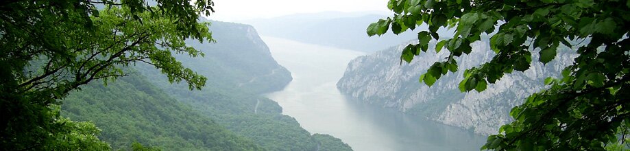
In 1972 the Iron Gate Dam, 1278 m long and 60 m high (AQUAPROIECT 2003) was built on the border of Serbia (Figure 1) and Romania, flooding 12 settlements over an area of 14 500 ha and transforming the local way of life forever. This area in the Carpathian region of north-east Serbia has a rich cultural heritage. Many important riverside archeological sites from various historical periods were impacted by this flooding, such as Roman fortresses on Ada-Kaleh island, considerable parts of the Roman road, and memorial plaques to Tiberius and Domitian (Stanojlovic, 2005). Other sites were relocated to an upper shoreline zone, including the Trajan Table and the archeological site of Lepenski Vir (Stanojlovic, 2005). As it interrupted the flow of the Danube River the dam also resulted in the creation of Djerdap Lake, altering the local river ecosystem (Brezeanu et al, 2006, ICPDR, 2009).

Figure 1: Map of Serbia (Adapted from http://upload.wikimedia.org/wikipedia/en/e/e9/Europe_map_serbia.png)
Two years later the area upstream of HPP Djerdap 1 was designated a Protected Area (PA), and named Djerdap National Park (NP) The largest in Serbia, it occupies a surface area of 63 608 hectares (ha)‚ within a wider protected area of 93 968 ha. Intended as a measure for environmental protection, the founding of the NP and the dam construction have contributed to the deterioration of the inhabitants’ standard of living and an ongoing process of depopulation.
.
1.1 The Rich Heritage of Djerdap: Geography, Geology, Hydrology and Biodiversity
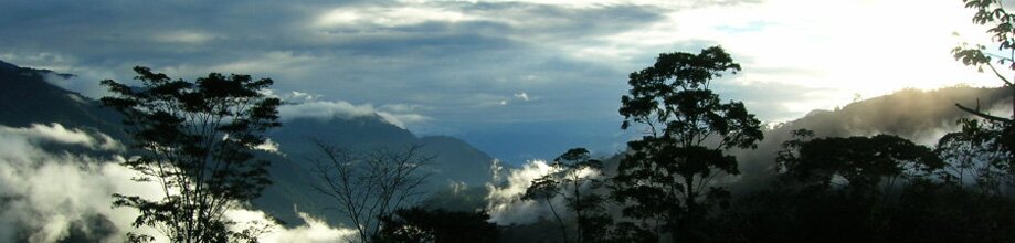
Home to a number of important ecosystems (Table 1), the park’s borders stretch from town of Golubac up to the Iron Gate dam near the village of Sip. The terrestrial part of the park is about 6 km wide and 100 km long. Upon entering park territory the Danube River passes through the longest European composite valley (about 150km long), comprised of 3 smaller gorges (Golubacka, Gospodjin vir and Sipska), 2 canyons (Veliki Kazan and Mali Kazan) and 3 valleys (Ljupkovska, Donjomilanovacka and Orsavska). The last and narrowest gorge of the system on the Danube River is called “Iron Gate” (in Romanian Porţile de Fier or in Serbian Gvozdena Vrata). The name originates from the Roman period, since the part of Djerdap Gorge near Sip, made river traffic almost impossible due to the presence of underwater rocks and fluctuations in water levels (Serbia Travel Club, 2008). The gorge divides the Carpathian and the Balkan Mountains and forms part of the border between Serbia and Romania. It is about 3 km long and 162 m wide, with towering rock cliffs that make it one of the most dramatic natural landscapes of Europe (Britannica, 2009). The name Iron Gate however is commonly applied to the whole 150 kilometer gorge system (Britannica, 2009) as well as to the dam. This area has the oldest geological history in Europe, with complex structures resulting from the impacts of climate and tectonic phenomena adding to its morphological diversity and richness. There are also numerous notable hydrological formations, including springs (for example, the spring of the Porecka River) and other small rivers and streams.
Table 1: Ecosystems diversity and surface (Source: Medarevic, 2001)

.
.
With regard to biodiversity, the territory of the NP is situated on the border of two different floristic regions: the middle-European region of temperate forests and the ponto-southsiberian or steppe-forests floristic region (Stevanovic, 1996). The park is one of the largest and most northerly European refugia for flora and vegetation of the Arctic-Tertiary period, with more than 50 different types of forest and bush formations, out of which 35 are relict (Medarevic, 2001). More than 900 species and subspecies of vascular plants inhabit the territory of the NP (Stevanovic, 1996), however a detailed database on the total number of species has not been completed yet.
The fauna of this area is also rich and various. So far 170 bird species have been noted, but it is thought that at least 200 bird species visit this area throughout the year. Numerous species of mammals are also present, including: the wildcat (Lynx lynx carpathicus), bear (Ursus arctos), wolf (Canis lupus), jackal (Canis aureus), chamois (Rupicapra rupicapra), deer (Cervus elaphus), otter (Lutra lutra) and others. A great number of species of insects, amphibians and reptiles also inhabit the territory of Djerdap NP. Before the construction of the Djerdap dam, the fish population was composed of species common to the Danube River, as well as semi-migratory species such as eel and other migrant species (sturgeons, stellate sturgeon, etc.).
Due to its specific geographical position, the presence of the river, the mild climate, and diverse and rare natural resources, the Djerdap region has been home to numerous human civilizations throughout history. There are archaeological sites all across the park territory dating from pre-neolithic times, through the Bronze and Iron Ages as well as Roman, Byzantine and Turkish epochs. Lepenski Vir for example, is an 8000 year-old archeological site of global importance holding the oldest known European human settlement (Misic, 1980). Historically, the strategic value of the area is evident in the number of military fortifications (as in Golubac) from different periods (Roman, Medieval, etc). Different cultures and civilizations have over time shaped and affected patterns of cultural development in the region. This cultural heritage has an important, non-monetary value, yet many of these priceless assets were forsaken due to dam construction and subsequent flooding.
.
Djerdap National Park is managed by the Djerdap National Park Public Enterprise (NPPE) based in the city of Donji Milanovac. The territory of the park is divided into three different zones of protection (Figure 2). The first zone (dark green) is dedicated to the strict protection of natural and cultural heritage. The second one (medium green) covers the area surrounding the first zone and applies to special nature values (specific ecosystems, landscapes etc.), and natural areas around cultural monuments. The third zone (light green) applies to NP territory outside the borders of the first and second zones of protection, and permits activities such as: tourism, sports, recreation, forestry, water use, potential exploitation of mineral resources, urban construction and development etc.
The main source of funding for Djerdap NP management comes from the timber trade, with some income from the state budget allocated for the management of private forests and cultivation activities in state forests. There is also a small amount of income from taxes on non-timber forest product collection and from hunting and fishing (licenses) (Nestorovic et al, n.d.). The fact remains however that Serbian NP enterprise revenue to a great extent depends on returns from logging, illustrating that the line between over-exploitation and sustainable use of resources in any protected area can easily be crossed. In light of the impacts of dam construction and NP designation, this case study aims to explore how the economic prospects of local communities might be improved through reliance on local resources given the vast potential of this area. It is the belief of the authors of this study that the development of a long-term sustainable, social-ecological system could enhance the management of local cultural and natural wealth and empower the local community.

Figure 2: Djerdap NP in Serbia and the 3 zones of protection marked in green (Adapted from Djerdap National Park website, www.npdjerdap.org)
.
1.4. The Djerdap Dams and the Hydro Power Plant System
The biggest construction project ever undertaken on the Danube River is the Djerdap Hydro Power Plant System, designed for energy production and regulation of river transport (Figure 3). The dams also contributed to the establishment of road connections between Romania and Serbia.

Figure 3: The Danube River Basin with HPP Djerdap 1 and 2 (Source: Todoru et al. 2005)
.
The Djerdap Hydropower Plant System (Djerdap HPP) is 100% state owned. While its main activity is electricity production, the company also provides services related to river and lake transport, namely navigation of boats through the dam canal system.
The Djerdap 1 hydropower plant (Figure 4) was built between 1964 and 1972, 943 km from the confluence of the Danube into the Black Sea. This is the largest hydro-technical construction on the Danube River with a total length of 1278 m (AQUAPROIECT 2003). It is symmetrically and equally shared between Serbia and Romania, as is the total quantity of energy produced. The dam and its facilities are situated on the border of Djerdap NP and electricity production systems are constructed so they can supply energy to both territories equally, in response to local demand or shortages in either State. The basic parameters of the hydro-power-plant (HPP Djerdap, 2008) are as follows:
• Total power – 1026 MW
• The maximum flow – 4800 m³/s
• Total volume of the accumulation – 2800 x 106 m3
• Average production per year – 5.65 billion kWh

Figure 4: Djerdap 1 (Source www.djerdap.co.rs)
.

Figure 5: Djerdap 2 (Source: http://staklenozvono.rs/wp-content/gallery/elektroprivreda-srbije/he-djerdap-ii.jpg)
.
Since becoming operational, Djerdap 1 has produced 204.35 billion kWh of electricity and more than 50 000 ships have passed through the dam canal. The Serbian segment of the canal can carry ships of up to 5000 t directly to Belgrade, Serbia’s capital city. After 35 years of operation, work on the modernization of Djerdap 1 commenced in 2008. Djerdap 2 (Figure 5) is the second largest hydro-power-plant on the Danube River between Serbia and Romania. Its construction lasted from 1978 – 2000, and it is located 863 km from the Danube Black Sea delta (Kusjak-Оstrovul Mare). It has a total accumulation volume of 716.5 x 10⁶ m3 and total power of 270 MW. In addition to these two sites, another project has been proposed: a reversible hydro-power-plant, “Djerdap 3″, is planned near the Lepenski Vir archaeological site – 162 km downstream from Belgrade.
.
2. Impacts of the Dam and National Park Status
2.1. Impacts on Ecosystem Services
Djerdap NP plays a significant role in supporting and enhancing ecosystem services (ES), defined as the benefits natural ecosystems provide to mankind (MA, 2003, 2005). All four types of ecosystem services (ES) classified by the Millennium Ecosystem Assessment are provided by Djerdap NP. Besides playing an important role locally, they are also important on regional and global scales. Unfortunately, all types of ES provided by Djerdap NP have come under threat as a direct consequence of dam construction and inadequate NP management (Table 2).
.
Natural ecosystems play an important role in waste treatment. The ability to absorb, or process waste varies among systems, and if some materials are released too rapidly, can modify ecosystem functioning (MEA, 2005). This is often the case with metals that cannot be converted to harmless materials, but are released in accidental spills in the Danube, accumulating in the dam.
Healthy ecosystems play an important role in moderating the severity of extreme events, the frequency of which is expected to increase with climate change. Also, the functioning of climate and natural ecosystems are intertwined, so the stability of one depends on that of the other, providing an important ecosystem service (Daily et al., 1997). Water is required for life on Earth and in that way supports all other ecosystem processes. Forests, furthermore, regulate the water cycle, in particular, mitigating floods, droughts, the erosive forces of wind and rain, and silting of dams and irrigation canals. As the forest in the Djerdap NP is an important carbon sink, sustainable forest management in the NP is of great importance.
.
Table 2: Threats to Ecosystem Services in Djerdap NP
| Ecosystem service type | Threats to Djerdap NP |
| Supporting (necessary for the production of all other ecosystem services, include soil, photosynthesis, primary production, nutrient cycling and water cycling) |
Unsustainable forestry threatens
|
| Provisioning (products obtained from ecosystems, including food, fiber, fuel, genetic resources, biochemicals, natural medicines, pharmaceuticals, ornamental resources and fresh water) |
|
| Regulating services (including regulation of air, climate, erosion, water purification, disease, pest, pollination, and natural hazards. |
|
| Cultural services (non-material benefits people obtain from ecosystems through spiritual enrichment, cognitive development, reflection, recreation and aesthetic experiences) |
|
.
The gathering of forest products is generally under strict control, nevertheless a more efficient use of ecosystem products would be beneficial. Drinking water in particular faces real threats from inappropriate waste management practices, an important issue not only in Djerdap NP, but in the whole country. While improvements in waste management systems are underway, increased pressure on the Danube River’s inland waters is anticipated with increased river transport. Environmental problems associated with inland waterway traffic include: water pollution from engines and illegal waste dumping, mechanical and noise disturbance of aquatic biota and surrounding ecosystems, and increased risk of introducing exotic species via ballast waters.
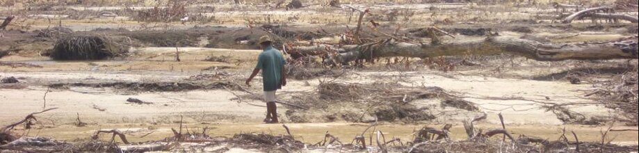
Negative impacts on the quality of Djerdap dam water are already visible. The creation of the lake changed the natural water flow and its capacity for self-purification. Furthermore, a variety of industrial accidents in the upper Danube and its tributaries have led over the years to an accumulation of heavy metals. Sediments are rising faster than initially predicted, and have taken only 20 years to reach the acceptable maximum level, instead of the predicted 50 years. According to International Commission for the Protection of Danube River (ICPDR), in the backwater zone of the Djerdap Dam, 325 million tons of sediment accumulated between 1972 and 1994, using up 10 % of the entire reservoir capacity (ICPDR, 2005). According to total measurements of suspended solids, “long-term storage loss of 0.6% per year has reduced the storage capacity of the reservoir by 20% after 30 years of usage” (Teodoru et al., 2005). Locals estimate that sediment levels have already exceeded the permitted limit by 1 meter (Endemit, 2009), but the cleaning of the dam will be an extremely expensive task, and problematic due to the issue of disposing of the huge amounts of sediment. Furthermore it is not clear when and by whom it will be accomplished.
Downstream coastal erosion has intensified as a result of the dam, as has incision of the river bed (ICPDR, 2005) The most controversial effect however is the fact that today, instead of preventing flooding, the dam has become a catalyst for floods, by raising the level of the Danube and its underground tributaries all the way to Hungarian border in the north. Combined with other impacts of climate change, this contributes to a dramatically higher risk of flooding nation-wide.
Other potentially irreversible negative changes are occurring in the water regimes of the area. These are, visible for example in changes in composition and degradation of the shallow waters and coastal ecosystems. With the slowdown of the river flow in artificial accumulations and related build-up of organic substances, sediments and other pollutants (heavy metals, pesticides, row materials etc.), water quality has been severely affected, increasing the risk of destruction of specific life forms and entire ecosystems, with coastal ecosystems particularly vulnerable
.
The non-material benefits that people obtain from Djerdap NP are numerous. Djerdap NP is home to a wide range of historical remains of great importance which add to the area’s landscape value, and form part of the national cultural heritage. Construction of the dam for example destroyed a large part of the Lepenski Vir site, and while some monuments and artifacts were transferred to the upper zones of the riverbank, most of the original findings such as graves, foundations of shelters etc. were destroyed forever.
The park’s purpose is to conserve and enhance the natural beauty, wildlife and cultural heritage of the area, as well as to promote opportunities for the public to learn about and enjoy the special qualities it offers. Critical for life-sustaining processes, ecosystem services are usually perceived to be free of charge (WWF, 2007). This perception ultimately has a negative impact on local communities, as not only are they often poor, but they are also directly dependent on the exploitation of local ecosystems. Although a PES scheme could probably be designed for Djerdap NP, it is unlikely in the near future due to outstanding property rights issues (see 2.3 Other Social Impacts).
.
2.2. Impacts on Local Economy and Livelihoods
Numerous negative impacts from the dam and NP-related restrictions on resource use have created a situation in which more rather than fewer unauthorized activities such as fishing, logging and hunting are taking place in local communities.
.
2.2.1. Forestry
In Djerdap NP, 43 537 ha out of 63 680 ha is forested, amounting to nearly 70% of the area. Upon designation as a national park, approximately 36 518 ha of the forested area was registered as state and 7018.3 ha as privately owned. Although private forests are managed by their owners (Law on Forests,1991), private forest owners must have a management plan; assigning trees before cutting; paying the toll on cutting wood; sealing cut wood and issuing waybills for transport. These procedures and tolls are designed to ensure better protection of private forests and to decrease their exploitation. The NPPE gives technical support and carries out its obligations through issuing the licenses for cutting, assigning trees for cutting, giving licenses for the transport of wood and organizing activities for forest protection (Fornet et al., 2009). The entire territory of Djerdap NP is also divided across the jurisdiction of three municipalities (Table 3).
.
Table 3: Forest ownership by municipality (Adapted from General Framework for Forest Management of the Djerdap National Park, 2002)

Forested areas within the park are divided into categories with specific functions, including strict nature reserves; scientific-research reserves; forests around cultural and historical monuments; erosion protective forest cover; and recreational forests (Medarevic, 2001). Of this total area, only 5.88 % lies in the first zone of protection, with the rest falling under the second and the third zones (see Table 4) in which use of forest resources (including timber) are allowed. Forests in NP territory as mentioned previously are managed by the NPPE, and this authority is in charge of labeling timber from protected areas. Gathering of the medical plants and other forest products, the use of stone, shingle, humus and other non-timber products, and bee farming are also allowed with permits issued by the NPPE. Significant natural resources for immediate use are provided by non-wood forest products. These include forest fruits, medicinal herbs, mushrooms, stone, gravel and other. Reliable data on the potential of these resources is not available (Fornet et al., 2009), however it is possible to make some estimates. For example, according to the General Framework for Forest Management of the National Park, the expected yield of mushrooms over a two-year period is 15 t. According to unofficial sources, with an average price of 5€ / kg, this amounts to just over 76 000 €.
.
Table 4: Forest surface by protected zone (Source: General framework for forest management of the Djerdap National Park, 2002)

Forests in Djerdap NP are managed in line with principles of classical forest economics (see Faustamann and Hartman Rules below), and the municipality of Majdanpek provides a typical example of forest use in the region. In this municipality, 36% of forests are under state ownership and managed by the NPPE. The main forest products in this vicinity are technical wood (up to 25%) and firewood (75%) extracted to meet the fuel needs of the local population and for trade. (Table 5). Fire wood and wood of lower quality from local forests is also used for charcoal production (Fornet et al., 2009).Table 5 shows the entire amount of wood produced privately as well as on state owned park land, illustrating the economic role of forestry in the municipality of Majdanpek.
.
Table 5: Wood production in the Municipality of Majdanpek in 2008 (Source: Fornet et al., 2009)

The Faustamann Rule, a model of classical forest economics, is used to calculate the ideal rotation period with an infinite time horizon when the “cyclical dynamics of forest management are constrained to clear-cutting”. It computes the age at which an even-aged forest stand (plantation) should be harvested in order to maximize the return to forestry (Touza-Montero & Termansen, 2001). It focuses on the age-class structure of forest stands assuming all rotations of land are identical (Touza-Montero & Termansen, 2001). According to this rule, the optimal time to harvest the standing forest is when the marginal benefits of delaying the harvest equal the opportunity costs of waiting. The price of product is the key input for this principle (Raunikar & Buongiorno, 2007) that considers only timber products.
In addition, the Hartman Rule (1976) takes into account “the additional flow of amenity outputs if the harvest is delayed and the ‘site value’ includes both timber and non-timber benefits” (Touza-Montero & Termansen, 2001).
Forest protection should be of the highest priority in the Djerdap NP due to its role in climate regulation and global threats of deforestation. Nevertheless, there are obstacles to practicing sustainable forestry in this area.
• The definition of “forest”
According to UNEP/CBD, 2001 a forest is a “land area of more than 0.5 ha, with a tree canopy cover of more than 10 percent, which is not primarily under agriculture or other specific non-forest land use…”(FAO, 2007). This definition, based on physical properties of vegetation rather than by land use (Verchot et al. 2005 in FAO, 2006) can also apply to tree plantations that are primarily used for forestry and protection purposes, as in the case of Djerdap. The core argument against this categorization of course is that a forest is an ecosystem rich in biodiversity while a plantation, recognized as “forest/other wooded land of introduced species and in some cases native species, established through planting or seeding” (FAO, 2006) is not. Djerdap NP features mainly rich natural forests composed of indigenous trees. Consequently, they should be managed in line with principles of sustainable forest management, which call for “the stewardship and use of forests and forest lands in a way, and at a rate, that maintains their biodiversity, productivity, regeneration capacity, vitality and their potential to fulfill, now and in the future, relevant ecological, economic and social functions, at local, national, and global levels, and that does not cause damage to other ecosystems” (The Ministerial Conference on the Protection of Forests, 1993).
• Finding a balance
The appropriate balance between classical forestry management practices which aim to maximize profit in order to meet the increasing demands of society for forest products, and protection of forest health and diversity has not so far been attained. Management policies have been poorly implemented due to unfavorable political conditions and difficulties related to the transition from communism to a market based economy. Current management plans furthermore have been dictated by market demand for wood instead of the pursuit of sustainable management objectives.
• Exclusion of community
The local population in Djerdap NP is not allowed to use forests without special consultations with and authorization from park officials, even if privately owned. Locals also need to pay to take fallen wood from the forest. Forests products are traded by the NPPE in national and international markets but revenues from neither timber nor non-timber products are directed to the budgets of municipalities or local communities.
Furthermore, community members complain that in light of restricted access to forests, posts in the NP forestry sector (including management, maintenance and protection) are limited, and not reserved for local residents (Endemit, 2009). In 2002 for example, direct employment of the local population in the forestry sector was as follows (NPPE 2002):
• 6 out of 11 forestry engineers,
• 20 out of 28 forestry technicians
• 6 out of 6 assistants
Apart from employment matters, local communities also complain about the quality of infrastructure. Municipal governments are responsible for road maintenance, but village roads are heavily and continuously damaged by the trucks that transport wood cut in the NP without compensation for logging related damage to roads.
.
The hunting grounds of Djerdap NP have been managed by the NPPE since 1990. Covering a surface of 63 608.45 ha, they are 100 km long, and range from 2-10 km in width. Of the total zone, 23 483 ha or 36.92 % is private property and 40 125 or 63.08% is state owned. Hunted species include deer, roe deer, wild boar, chamois, hare, partridge, and pheasant, but protection and breeding are also approved user activities.
Two hunting societies with 300 members in total operate within the borders of the hunting area. Hunters must sign annual contracts with the NPPE, and in exchange pay a fraction of market prices for the game they take. They pay 20% for small game, 30% for large game and 50% of the market value of large game meat. Although these prices can be seen as fair relative to market prices, interviews with local hunters revealed dissatisfaction as they are just one set of fees that local hunters must pay, for the use of hunting grounds reduced by flooding, and in competition with relatively better-off hunting tourists (Endemit 2009).
The Framework for Hunting in Djerdap shows that in a period of ten years (1993 – 2003), income was mainly derived from shooting and game meat fees (see Table 6). Although precise up-to-date data on earnings from hunting is not available for comparison with total park revenues, we can conclude that a perverse situation exists in the country’s “protected” areas and national parks, whereby income is generated mainly from shooting animals, rather than from breeding them, or running nurseries or veterinary services.
.
Table 6: Incomes from Hunting 1993-2003 (Adapted from: Framework for Hunting in “Djerdap” Hunting area: for period 01/04/ 2003-31/03/2013)

.
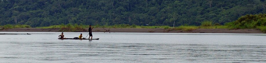
Generally, trends show a decrease in the amount of fish caught in the Djerdap region, with populations of autochthonous (indigenous) species on the decline. Between 1990 and 1999 the catch shrank drastically from 138 t to 23 t (Jankovic et al, 2000). In the same period however there was a ten-time increase in the total catch of herbivore fish species. This is mainly because these species are adapted to thrive in the lake ecosystems and slow waters of Djerdap Lake. Meanwhile, alien species like carp (Hypophthalamichthys molixtris and Aristichthys nobilis) and topmouth gudgeon (Pseudorasbora parva) have appeared and their numbers are growing.
The negative impacts of the dam on fishing are most visible within the native sturgeon population that has disappeared from the upper flow of the Danube. Hydro-morphological alterations and the creation of two accumulation ponds for the dam meant that the watercourse was slowed down, affecting changes in the entire aquatic ecosystem. The dam itself furthermore obstructed the passage and migration of sturgeon, one of the most important commercial species for local fishermen, not just for the fish itself but also for its high quality caviar. Besides sturgeon, numbers of many other native species, like the common carp Cyprinus carpio), common barbell (Barbus barbus), zander (Stizostedion lucioperca) and wels catfish (Silurus glanis), have been decreasing since the appearance of the dam.
Fishing permits are expensive for residents according to interviews conducted with members of the local community (Endemit, 2009). An annual professional fishing license costs approximately 1000 €, and as in the case of hunting, local people have to compete with better-off fishing tourists to make a living from increasingly scarce fish stocks. Although the figures for park revenue from licenses are not available, we do know that the average annual commercial fish catch was 22 336 kg from 1995-2000, while the average sport fishing catch in the same period was nearly half of that, 10 500 kg, with 453 sport-fishing licenses issued.
An Action Plan for sturgeon species management was developed in 2005 (Lenhardt et al., 2005) comprising sets of measures and recommendations for protection of these endangered species. It includes the roles of many stakeholders from relevant ministries, the scientific community, and fishermen’s associations to local communities. One measure proposed for sturgeon protection in the Action Plan was the further development of aquaculture, which potentially could provide a good source of income for the local community. However, the Action Plan has not been consistently implemented due to changes in national government.
.
Ancient Angling in Djerdap Lake
The “Golden Fish bait” (Zlatna bucka) is an angling contest that has taken place on the Djerdap lake, near the town of Tekija every summer since 1984. The contest is based on an ancient local way of fishing. The bucka is a wooden stick 50 cm long, used to make a noise on the water’s surface to attract catfish from the bottom. This traditional way of fishing is possible when the water surface is calm, which makes Djerdap Lake, 14 km upstream from the hydropower plant, a perfect location. The aim of the competition is to catch the biggest fish, although the amount of the fish caught counts as well. Catfish in this part of the Danube River can weight more than 50kg. The competition lasts for three days, with around 120 participants – 60 competing couples.
.
As already mentioned, the majority of agriculturally productive land in the area was submerged when the dam was built. Villages were removed from the rich livelihood-providing shores of the river and relocated to less fertile hilly land in compensation. This was a major contributing factor to the diminished role of the agriculture sector in the local economy.
According to interviews with locals, the few gardens and little livestock still kept are under constant threat of damage by protected wild animals, mainly boar. Locals complain that financial support for the installation of fencing is not available, and that while compensation for this damage was once paid for out of timber revenues, today such compensation is insufficient.
The government has developed an initiative to support the agricultural sector financially, but eligibility for the scheme requires the registration of agricultural land in the official cadastre (Republic of Serbia, 2005). This measure is intended to improve government data on agricultural trends in Serbia. Unfortunately however, many small farm owners are unaware of these measures, and do not make use of them. There is a clear need for workshops with agricultural specialists and representatives from the Ministry of Agriculture, Forestry and Water to help the local people to understand their rights and develop a strategy for the further agricultural improvement.
.
In Djerdap there is a tradition of livestock rearing, although past, implementation of high taxes on grazing led to people giving up animal husbandry. Relocation due to flooding also affected traditional livestock rearing. The local community sees potential for livestock production, especially for sheep and goats on the more recently occupied hillier ground. However, the absence of any organized milk or meat markets makes this unfeasible for the time being. An economic study of the amount of meat and milk that could be sold in this region is therefore a precondition for any animal husbandry development strategy. Should market conditions develop sufficiently, the transport of milk and meat will also be an important consideration in the NPs strategy for sustainable transport. Organic farming, which is not being practiced at the moment, represents another potential area of development that could contribute to the development of eco-tourism in Djerdap NP.
.
.
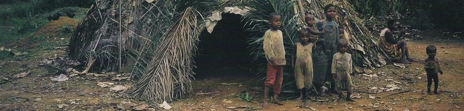
2.3.1. Emigration
The completion of the dam in 1971 and creation of the 1278 m long Djerdap Lake involved the flooding of 12 settlements, with many thousands inhabitants (EPS, 2009). (according to various sources from 10000 to 23000). Among these were three small towns – Donji Milanovac and Tekija in the Republic of Serbia and Orsava in Romania – whose inhabitants were resettled on higher ground above the flooded areas. The total area submerged was estimated at 14 500ha (EPS, 2009).

Figure 6: Population decline in the Djerdap region in the period 1948- 2002 (Data source: Statistical office of Republic of Serbia)
.
This flooding had a “domino effect”, triggering many negative social consequences, all of them contributing to emigration from the area and an unsustainable trend of depopulation (see Figures 6 and 7). First, as settlements lost their municipal status, health care and administration centres were relocated to surrounding cities which were in some cases as far as 80 km away, detracting further from local living conditions. Once flooding had submerged the majority of arable land, the population was forced to change its way of life. People were offered limited opportunities to work for the Djerdap Hydro Power Plant system (HPP) and for newly built industries (see text box below), but many at this point decided to leave their homes instead.
.
Emigration and Depopulation in Djerdap NP
The majority of the Djerdap population is between 45 and 64 years old and the population is aging. There is also a low birth rate and a relatively small proportion of females in the region. For the past 8000 years, the natural characteristics of Djerdap NP determined the position of human settlements within the area, until the construction of the HPP and the creation of Djerdap Lake when settlements were shifted 1-2 km uphill from their previous positions.
Today one city (Donji Milanovac) and nine villages are spread across three municipalities: Kladovo (Tekija, Novi Sip and Petrovo Selo), Majdanpek (Mosna, Golubinje, Topolnica, Donji Milanovac and Boljetin) and Golubac (Dobra and Brnjica). In addition there are 10 other towns/villages that partially lie in the NP area. In total, 10 499 inhabitants live on Djerdap NP territory (Statistical office of Republic of Serbia, 2002).
Population Dynamics and growth
There was a positive trend in the population growth of the whole country from 1948-2002 (Figures 3 and 4). Nevertheless, the growth rate has been declining since the 1980s. Djerdap NP had the highest number of inhabitants in 1961, with over 13,000, and the lowest in 2002, with just over 10,000 people (Figure 3). This decline is reflected in the rapid aging of the rural population, the abandonment of rural settlements, a shortage in the agricultural labor force, and a consequent decrease in agricultural production (LEAP 2005).
Population growth until the 1980s can be attributed to economic expansion in northern part of Eastern Serbia, which resulted from the development of the mining and metallurgy and the chemical industries in Prahovo, and hydro power plant construction. These causes led to an influx of immigrants from surrounding areas until the economic crisis in Serbia in the 1990s. In the same period however, peoples of the southern area of the NP (in Kladovo and Negotin) had begun to emigrate to more developed countries.
Emigration: three waves
The first wave of emigration from Djerdap and Serbia as a whole began in the early 1960s, initiated by the opening of the country’s borders and the migration of the poor and uneducated, mainly toward Western Europe. As a result, several large companies in Donji Milanovac closed down as well as some of the mines in the region. This trend was halted only slightly by the opening of the first phase of operations of the Majdanpek copper mine in 1961.
The second wave took place from 1966 to 1975, caused by the flooding of agricultural land and settlements on the territory of Donji Milanovac, Mosna and Golubinje. Delays in the construction of new wood processing facilities also negatively impacted the availability of employment opportunities, although some relief came from the opening of the second phase of copper mining activities in Majdanpek in 1966. This contributed to growth in the population there from 2,244 inhabitants in 1953, to 11,760 in 1991.
Due to the impacts of the dam and protective measures which left the local population with few remaining livelihood alternatives, the third and current wave of emigration began in the 1990s. Causes can be traced to the collapse of the Federation of the Yugoslav Republic, the impacts of civil wars in Croatia and Bosnia and Herzegovina, economic sanctions imposed on Serbia, hyperinflation and finally the devastation of the NATO bombing of 1999. With the beginning of economic privatization and reconstruction in Serbia, many people lost their jobs, which intensified emigration to the more developed parts of Serbia and abroad. It didn’t help either that an HPP compensation scheme that began in the nineties to compensate for flooding damage was halted in 2006, depriving local communities of badly needed assets to support local economic development.
It is the hope of the authors of this chapter that measures to stabilize the population and to improve the overall living conditions of local communities will reverse depopulation processes and also have a positive effect on the population structure.
.
 Figure 7: Change in the number of inhabitants per settlement, in the period 1948 – 2002 (Data source: Statistical office of Republic of Serbia)
.
The HPP did not exclusively employ local people, who had to compete for jobs with other Serbians from elsewhere. An industrial zone was established after completion of the HPP to provide employment opportunities for people affected by the dam, but these enterprises are now for the most part either closed, or operating below original capacity. There remains a lack of available employment: jobs are mostly seasonal, and people have to rely on family or agricultural pensions, which are less than the average state pension. For a great many people the social security system is their only source of income, which is a burden on both municipalities and the country.
.
The displacement due to flooding also created property rights issues that remain unresolved. As land was taken over by the HPP, existing settlements were not registered in the land cadastre. This complicated procedures for construction or property selling by locals, which have become longer and costlier, creating a situation that now needs to be addressed on a national level.
top.
The dam and its reservoirs have lead to a loss of natural resources, the destruction on habitats, the displacement of people and destruction of cultural heritage, all without passing on any benefits of increased electricity supply to local rural communities. The principal beneficiaries of dam-building have without a doubt been the urban-industrial sectors, for which the expansion of electricity generation in the early 1970s opened the way for large heavy industry, and factories making shoes, textiles, and other products which undercut artisan and local-domestic production.
The poor economic situation in the country, inadequate management and restrictions on the use of resources have all contributed to the encouragement of illegal logging, fishing and hunting activities. Furthermore, there is evidence of unauthorized collection of forest products and illegal construction of tourist facilities. This situation has resulted in conflict between park management and local communities. Although the conditions for the development of different economic activities that comply with principles of sustainability are present, the local population remains poor and vulnerable to a rapid process of unsustainable depopulation, as the majority of young people from this region now work far from home, having abandoned traditional ways of life in a search of better life opportunities.
.
3. Reappraising the costs and benefits of hydropower: moving toward inclusion
Cost benefit analysis (CBA) is a neo-classical economic tool that aims to identify the project plan or policy that has the greatest net present benefit, and will therefore maximize economic efficiency. In short, it compares benefits with costs of projects, both translated into net present value. When the Djerdap dam was built no CBA was carried out, however even if one had been, it would not have taken into account cultural costs and the costs of destroying a pristine natural environment in exchange for the economic benefits of hydroelectricity.
If a CBA had been carried out however, modified in line with the John Krutilla’s rule (Krutilla, 1967), it would have taken into account the non-use option value of keeping an irreplaceable natural area with a rich cultural heritage intact. Krutilla and Fisher argue that technological change tends to reduce the benefits of developments such as hydroelectricity because superior electricity generating technologies will evolve over time. Cultural and environmental assets, along with a positive rate of technological change would have been counted as part of the opportunity cost of building the Djerdap hydropower plant. In future, hydropower could be substituted with new technologies and thus electricity produced from hydropower plants could become cheaper and more abundant. The possibility of the emergence of new technology would lower the present value of the hydroelectricity, raising its discount rate.
On the other hand, beautiful landscapes are irreplaceable, their supply is inelastic (fixed) and they will be a scarce asset in the future. The same stands for cultural heritage. Consequently, the value of the pristine nature and rich cultural heritage would increase and the applied discount rate in a CBA would be lower than that of hydroelectricity. This approach to a CBA would ultimately provide an argument against the construction of hydropower plants.There is also an ongoing debate about whether hydropower should be considered a renewable energy resource due to its many negative environmental impacts. Generally, small hydropower plants, up to 10 MW, are included in renewable energy production, unlike big power plants that usually involve significant negative environmental impacts. According to the new Law on Environmental Protection (adopted in 2004) and the Law on Integral pollution prevention control, the Hydro-Power-System is obliged to undertake all measures possible in order to prevent negative environmental impacts and to compensate for any harm done (Polluter Pays principle). The new Law on Waters (under preparation) also means the HPP must consider the effects of river flow disturbances, because the management of waters will be based on river basin management principles, which is currently not the case.
.
4. Opportunities and Threats: Transport and Tourism
4.1. Transport
Djerdap NP has a significant position with respect to transport and traffic. However, the roads are of low quality and river transport is underdeveloped. The Djerdap Road connects Belgrade, Pozarevac, Veliko Gradiste, Golubac, and Donji Milanovac with the cities of Kladovo and Negotin. About 100km of this road passes through park territory, and is important because it connects all of the settlements and historical sites along the river bank. A major precondition for shifting toward sustainable transport in Djerdap NP is the implementation of traffic calming measures, which could be achieved without excessive effort through speed limit enforcement and gateway signs.
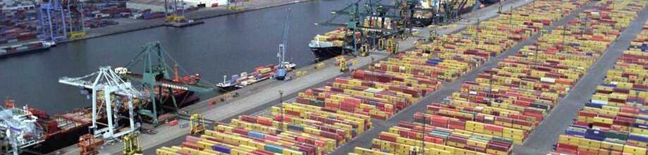
The Danube River is the main inland waterway in Serbia carrying nearly 90% of total inland water traffic. The section that flows through Djerdap NP is also about 100 km long and stretches from the city of Golubac to the city of Kladovo. An international river course, it holds significant potential for the development of river transport in the region. However, pre-existing issues such as the deterioration of water quality, drops of water levels and negative changes in water regimes due to the numerous dams constructed upstream should be addressed beforehand.
At present the Djerdap NP is seriously threatened by unsustainable road and river transport, and its resultant noise, pollution, threats to biodiversity, and negative visual impacts. All of these diminish the ability of the park to protect the area’s biodiversity, landscapes, natural ecosystems, and cultural heritage. One opportunity for sustainable transport under development is a European initiative to create a cycle corridor along the Danube River. In 2003 cycling experts with financial support from the German Technical Cooperation have began working on establishing a bicycle route along the Danube from Budapest to the Black Sea. This led to the first detailed bicycle map of the area, signposting of parts of the route and the launch of an informative web-page with information, recommendations and travel reports. The Danube cycling route has been accepted as a part of the Euro Velo Route No. 6, stretching from the Atlantic Ocean to the Black Sea. Nevertheless, limited signposting has been put up, and no proper cycling infrastructure has been developed. Improvement of the cycling infrastructure and its promotion could be important initial steps towards the development of sustainable transport development as a source of income in Djerdap NP.
.
The cultural heritage of Djerdap NP offers many opportunities for tourism, with hotspots like Lepenski Vir, the Tabula Triana (a stone tablet set by the Roman Emperor Traian in 104 AD), and the Golubac Fortress, In addition the park’s rich biodiversity, and the magnificent Danube gorge have much to offer visitors. The development of sustainable tourism, with optimum use of environmental resources, maintaining essential ecological processes and conserving living cultural heritage and traditional values (USAID, 2005), has the potential to improve the economic situation of this region.
The Ministry of Economic and Regional Development has proposed The Serbia Tourism Strategy, and within it the Master Plan of the Lower Danube Region (2007). The strategy aims to provide economic improvements and employment opportunities, to develop the Serbian image internationally, and to protect natural and cultural resources through sustainable tourism development. The Master Plan is rather general, but the NP and its inhabitants could design activities in line with the proposed strategy. To this end, cooperation between the local community and the Djerdap Tourism Organization must be improved, and the local population more involved in tourism development. Focusing on rural eco-tourism for example, could provide opportunities in recreation and leisure, and to experience local food and customs.
Improvement of the area’s capacity for tourism however necessitates infrastructure development and improved quality of accommodation facilities. However, building permits are difficult to obtain and highly taxed (by both the state and the NP), and procedures for company registration are onerous, so investment in development of tourist facilities has not been easy to attract, contributing to a great deal of illegal construction. Engagement with local communities for the development of the next NP management plan it is hoped will lead to the removal of some of these obstacles, through for example tax exemptions and more flexible construction procedures for residents. However, new construction and tourism facilities should be limited to traditional ethno-housing in a natural environment, within sustainable tourism practices, instead of facilitating large-scale tourism, which would drive environmental degradation.
Of course, the promotion of tourism in Eastern Serbia brings with it the risk of an increased number of private vehicles in the NP, so the success of sustainable tourism in part depends on the implementation of sustainable transport measures and infrastructure. Djerdap NP could be marketed to both visitors and commuters as an opportunity for guests to contribute to the development of an internationally renowned sustainable tourism site. The promotion of the park as such could be linked to the development of a coordinated sustainable transport network of buses, bicycle trails, boats and footpaths linking all of the major villages and attractions in the NP. Such a network could be based on existing services with improvements made to timetable co-ordination, shared ticketing systems, marketing, and facilities for bicycle carriage and storage.
.
5. Conclusion: future steps toward trans-border cooperation
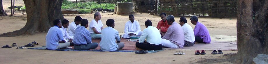
The local community has not been properly included in park management and has therefore been unable to articulate its problems and needs. These circumstances have weakened the management of the NP and ultimately led to opposition to the present top-down system of environmental protection. Community based conservation would bring benefits to both the environment and the community, with the potential to abate the emigration rate. If communities were to receive benefits, they would develop positive attitudes and have an interest in protecting local wildlife and ecosystems. Nevertheless, the integration of social concerns with ecosystem-based management requires a stable local population. While “business as usual” will lead to continued depopulation, emigration, loss of jobs and poverty, local communities do see opportunities for a better life and living standard in tourism (ethno and eco), animal husbandry, sustainable water transport on the Danube, and in participatory decision making for NP management (Endemit, 2009).
Endemit’s future actions and long term plans for Djerdap NP aim to put theoretical knowledge of participative democracy into practice. One of the first steps would be to foster local community participation in decision making. Priceless natural assets important for both biodiversity and eco-tourism lie along both the Serbian, and Romanian (Nature Park Portile de Fiera) banks of the Danube River. Accordingly, Endemit has initiated planning with Romanian CSOs for projects for biodiversity protection and economic development on both sides of the Danube. The first meeting was held in the Romanian city of Turnu Severin where representatives of Endemit, the Djerdap NPPE, the Romanian NGO Pro-Mehedinti as well as the Museum of Iron Gate assembled. This cooperative effort of cross-border cooperation is driven by the need to achieve the balanced, sustainable, socio-economic development of the Romanian-Serbian border area by increasing the economic vitality of the region and improving communities’ quality of life.
The case of Djerdap NP provides a clear illustration that “At the heart of the dams debate are issues of equity, governance, justice and power – issues that underlie the many intractable problems faced by humanity” (The World Commission on Dams, 2000). Proponents of dams stress that they are necessary for meeting societal needs: for more electricity, flood control, and for boat transport. But what of their devastating environmental and social impacts? These were completely neglected in the monetary calculations that estimated the benefits of the Djerdap dam, inflicting damages that 30 years later are still being felt in this region.
.
Recommendations for NP co-management
Serbian law has recognized local communities as legitimate legal actors in NP management for some time (National Parks Law, Official Gazettes of Republic of Serbia No. 39/93, 44/93, 53/93, 67/93, 48/94, 101/05 and the recently adopted Law on Nature Protection, Official Gazettes of Republic of Serbia No. 36/09). Still, in reality, the involvement of local people in Djerdap NP management is far below a satisfactory level, and this involvement is characterized by a lack of two-way communication between park officials and local people. Local communities in fact, view the NP as the main source (apart from the dam) of the underdevelopment of the area, rather than seeing any benefits from living there (Endemit, 2009).
Therefore, any future Djerdap NP management plan must focus on improving the efficient use of resources through a participatory approach that empowers the local community, and builds its capacity to work with partners and manage partnerships for the enhancement of cultural and natural assets, habitats and wildlife. Although common practice in other parts of Europe, concepts of co-management as a process of sharing responsibilities between government and local resource users and community based conservation remain confined within the Serbian scientific community, even though “many resources are too complex to be managed only by one agency” (Berkes, 2008), especially bearing in mind the importance and value of local knowledge and skills. Issues of equity, justice, empowerment as well as managing relationships (Berkes, 2008) are clearly at stake here.
In the course of preparing this case study, proposals for co-management were discussed with the local population (Endemit, 2009), to address the issues described herein. The further development of processes along these lines would be very useful for managing not only resources but relationships and communication between local communities and NP administration. Furthermore, as knowledge for dealing with ecosystem dynamics, resource abundance at various scales, trends and uncertainties, is dispersed among local, regional, and national agencies and groups” ( Berkes, 2008) this type of collaborative management benefit all parties involved.
.
.
AQUAPROIECT 2003. Dams in Romania: World Register of Largest Dams – Folios Concerning
Romania (Portile de Fier), www.dams.go.ro/rrmb/rrmb_d3.htm
Bellamy Foster, J. B. (2002). Ecology Against Capitalism. New York: Monthly Review Press.
Berkes, F (2008). Evolution of co-management: Role of knowledge generation, bridging organizations and social learning. Journal of Environmental Management 90, 1692–1702
Boserup, E. (1965) The Conditions of Agricultural Growth: The Economics of Agrarian Change under Population Pressure. Chicago, Aldine.
Brezeanu, G. and Cioboiu, O. (2006) The ecological development to the Iron Gate I reservoir. In: Proceedings 36th International Conference of IAD. Austrian Committee DanubeResearch / IAD, Vienna. ISBN 13: 978-3-9500723-2-7. pp. 224-229
Daily, C.G., Alexander, S., Ehrlich, P.R., Goulder, L., Lubchenco, J., Matson, P.A., Mooney, H.A., Postel, S., Schneider, S.H., Tilman, D., Woodwell, G.M. (1997) ECOSYSTEM SERVICES: Benefits Supplied to Human Societies by Natural Ecosystems.
The World Commission on Dams (2000) Dams and development. A framework for decision-making. Earthscan publications Ltd, London and Sterling, VA
Dutschke, M. (2002) Sustainable forestry investment under the Clean Development Mechanism: the Malaysian case. HWWA Discussion Paper 198. In FAO, 2006 b , Choosing a forest definition for the Clean Development Mechanism, http://www.fao.org/forestry/media/11280/1/0/
Endemit (2009): Focus groups and interviews with the local community in Donji Milanovac, Dobra and Tekija
Electric Power Industry of Serbia, PE (EPS) (2009) Environmental Protection. Belgrade, Serbia.
FAO (2007), Definitional issues related to reducing emissions from deforestation in developing countries. Available at: ftp://ftp.fao.org/docrep/fao/009/j9345e/j9345e00.pdf
Fornet, German Organization for Technical Cooperation (GTZ) & Majdanpek Municipality (2009): Forest-based companies, their roles and their potential to contribute to the economic development of the municipality of Majdanpek: A Feasibility Study.
International Commission for the Protection of Danube River (ICPDR) (2005) The Danube River Basin District: Part A – Basin Wide Overview, ICPDR Vienna International Centre, Austria
International Commission for the Protection of Danube River (ICPDR) (2009) Dams and Structures. Available at http://www.icpdr.org/icpdr-pages/dams_structures.htm. Accessed: Feb/2010
Krutilla, J (1967) Conservation Reconsidered, The American Economic Review, Vol 57/4, p. 777-786
LEAP office Bor, (2005) Ecological Action Plan of Bor District. Environmental Capacity Building Programme 2003. European Agency for Reconstruction
Lenhardt, M., Cakic, P. and Kolarevic, J. (2004) Influence of the HEPS Djerdap I and Djerdap II dam construction on catch of economically important fish species in Danube River, Ecohydrology and hydrobiology, Vol 4, 4:499-502
Lenhardt, M., Hegedis, A. and Jaric, I. (2005) Akcioni plan upravljanja jesetarskim vrstama u ribolovnim vodama Republike Srbije [Action plan for sturgeon species management in fishery waters of Republic Serbia]. Institute for Biological Research “Sinisa Stankovic”, Developed for Ministry of Science and Environmental Protection of Republic Serbia [In Serbian]
MA (Millennium Ecosystem Assessment), (2003) Ecosystems and Human Well-being: a Framework for Assessment. Island Press, Washington.
Medarevic, M. (2005): Tipovi suma Nacionalnog parka „Djerdap“.[Types of forests in Djerdap National Park] Faculty for Forestry, University of Belgrade, Serbia [In Serbian]
Medarević, M. (2001): Šume Đerdapa, Nacionalni park Đerdap i Ekolibri, Beograd.
Misic, V. (1980) Djerdapski refugijum – jedinstveni prirodni fenomen u Evropi (sa posebnim osvrtom na floru i vegetaciju). IV Simpozijum biosistematičara Jugoslavije, [Djerdap Refugio – unique natural phenomenon in Europe (with special emphasis on flora and vegetation). IV Symposium of Biosystematist of Yugoslavia)], Donji Milanovac, 1-24. [In Serbian]
Nestorovic, S., Nestorovic, Z., Popovic, D. (n.d.) Marketing pristup iskoriscenju vodotokova Nacionalnog Parka Djerdap
Panjkovic, B. and Pil, N. (ed.) (2004): Protected areas along the river Danube in Serbia. CSD presentation, Institute for nature protection of Serbia, Novi Sad.
PE National Park “Djerdap”, (2003) Framework for Hunting in “Djerdap” Hunting area: for period 01/04/ 2003-31/03/2013. Donji Milanovac
PE National Park “Djerdap”, (2002) General framework for forest management of the Djerdap National Park. Donji Milanovac
Raunikar, R., Buongiorno, J. (2007) Forestry Economics: Historical Background and Current Issues in Handbook Of Operations Research In Natural Resources, Springer, US
Stevanović, V., Jovanović, S., Lakušić, D., Niketić, M. (1995): Diverzitet vaskularne flore Jugoslavije sa pregledom vrsta od međunarodnog značaja. In: Stevanović, V., Vasić, V. (eds): Biodiverzitet Jugoslavije sa pregledom vrsta od međunarodnog značaja, 183-218 – Ecolibri, Belgrade & Faculty of Biology, Belgrade.
Stankovic, (1960) Yugoslav-Rumanian Iron Gates Project. RFE Evaluation And Analysis Department. Background Report Yugoslav Special No. 887/1960. Available at http://www.osaarchivum.org/files/holdings/300/8/3/text/122-1-230.shtml (Open Society Archives). Accessed: Feb/2010
Stanojlovic, A. (2005) The Iron Gate. Omladinski Sportski Kamp “Djerdap”. Available at: http://irongate.mojblog.com. Accessed: 01/2010
Stevanović, V. (1996): Samonikla botanička bašta [Native Botanical Garden] In: Angelus, J. (ed.): Nacionalni park Djerdap – Pamtivek prirode i čoveka. [Djerdap National Park – Long history of nature and man], IP Ecolibri, Ministry of Environmental Protection of Republic of Serbia, National Park „Djerdap“, 72-82, Belgrade.
Teodoru, C and Wehrli, B (2005): Retention of sediments and nutrients in the Iron Gate I Reservoir on the Danube River. Biogeochemistry 76, pp. 539–565
Touza-Montero, J., Termansen, M. (2001) The Faustmann Model as a Special Case. Workshop 2001: Conservation and Sustainable Development-Comparative Perspectives, Yale Center for Comparative Research
USAID (2005) USAID and sustainable tourism: meeting development objectives. Publication prepared by the Natural Resources Information Clearinghouse.
Vladić, V. (2005) Tamo daleko. Monografija o Porečanima i rasejanju. Donji Milanovac
Website of the Hydropower plant (HPP) Djerdap: www.djerdap.co.rs. Accessed: 12/2008
Website of the Ministry of environment and spatial planning: www.ekoplan.gov.rs/srl/index.php Accessed: 05/2009
Website of the National Park “Djerdap”: www.npdjerdap.co.rs . Accessed: 4/2009
Website of Serbia travel club (2008) Djerdap Gorge, Available at www.serbiatravelers.org/en/destinations/48-eastern-serbia/475-djerdap-gorge. Accessed: 01/2010
Website of the “Srbijaput” company: www.srbijaput.rs Accessed: 4/2009
World Wildlife Fund (WWF) (2007), Anja Kollmuss (SEI-US), Helge Zink (Tricorona), Clifford Polycarp (SEI-US) Making Sense of the Voluntary Carbon Market, http://assets.panda.org/downloads/vcm_report_final.pdf
Home to a number of important ecosystems (Table 1), the park’s borders stretch from town of Golubac up to the Iron Gate dam near the village of Sip. The terrestrial part of the Park is about 6 km wide and 100 km long.
Upon entering park territory the Danube River passes through the longest European composite valley (about 150km long), comprised of 3 smaller gorges (Golubacka, Gospodjin vir and Sipska), 2 canyons (Veliki Kazan and Mali Kazan) and 3 valleys (Ljupkovska, Donjomilanovacka and Orsavska). The last and narrowest gorge of the system on the Danube River is called “Iron Gate” (in Romanian Porţile de Fier or in Serbian Gvozdena Vrata). The name originates from the Roman period, since the part of Djerdap George near Sip, made river traffic almost impossible due to the presence of underwater rocks and the fluctuations in the water level (Serbia Travel Club, 2008). It divides the Carpathian and the Balkan Mountains and forms part of the border between Serbia and Romania. It is about 3 km long and 162 m wide, with towering rock cliffs that make it one of the most dramatic natural landscapes of Europe (Britannica, 2009). The name Iron Gate however is commonly applied to the whole 150 kilometer gorge system (Britannica, 2009) as well as to the dam. This area has the oldest geological history in Europe, with complex structures resulting from the impacts of climate and tectonic phenomena adding to its morphological diversity and richness. There are also numerous notable hydrological formations, including springs (for example, the spring of the Porecka River) and other small rivers and streams.
With regard to biodiversity, the territory of the NP is situated on the border of two different floristic regions: the middle-European region of temperate forests and the ponto-southsiberian or steppe-forests floristic region (Stevanovic, 1996). The Park is one of the largest and most northerly European refugia for flora and vegetation of the Arctic-Tertiary period, with more than 50 different types of forest and bush formations, out of which 35 are relict (Medarevic, 2001). More than 900 species and subspecies of vascular plants inhabit the territory of the NP (Stevanovic, 1996), however a detailed database on the total number of species has not been completed yet.
The fauna of this area is also rich and various. So far 170 bird species have been noted, but it is thought that at least 200 bird species visit this area throughout the year. Numerous species of mammals are also present, including: wildcat (Lynx lynx carpathicus), bear (Ursus arctos), wolf (Canis lupus), jackal (Canis aureus), chamois (Rupicapra rupicapra), deer (Cervus elaphus), otter (Lutra lutra) and others. A great number of species of insects, amphibians and reptiles also inhabit the territory of Djerdap NP. Before the construction of the Djerdap dam, the fish population was composed of species common to the Danube River, as well as semi-migratory species such as eel and other catadromous and anadromous migrant species (sturgeons, stellate sturgeon, etc.).